

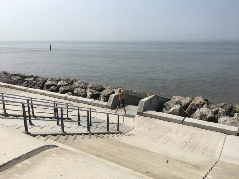
Rossall Seawall & Coastal Defence Scheme opened in June 2018. It’s function is to prevent flooding, but it’s also an amazing public facility for Fleetwood.
Take a look around this magnificent piece of civil engineering in this video:

Enjoyed this video? Why don’t you subscribe to the Visit Fylde Coast YouTube channel, for loads more great content!
The Rossall Coastal Defence Scheme
The Rossall Coastal Defence Scheme includes 2km of new sea defences (just over a mile) between Westway and Fleetwood Golf Course.
The scheme took four years to construct, at a cost of £64m and opened on 1 June 2018. It protects 7,500 properties from the risk of flooding.
It includes new revetments, seawall, promenade and rear wall. On the beach are rock groynes, with concrete cross over ramps to allow easy access on foot. Plus works to the grassed lagoon area (now known as Larkholme Grasslands) and floodwater channel on the landward side.
FREE Newsletter
FREE Newsletter

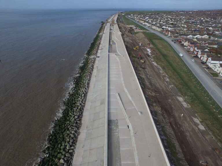
You can’t overestimate how much of a battering this section of coastline gets from the waves and wind. Together they pick up the shingle and pebbles and hurl them at the sea wall with incredible force. This is why harder-wearing rock is now used in the lower tidal area.
The next video explains how sea defences work. And this page goes on to show you what went into building the new wall.

Enjoyed this video? Why don’t you subscribe to the Visit Fylde Coast YouTube channel, for loads more great content!
Levels of Protection: Rocks
Each level of this sea defence performs a specific function and together the whole thing protects against flooding and erosion.
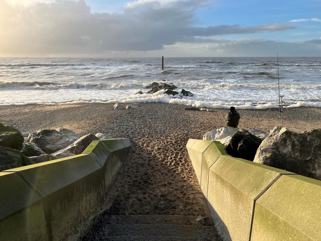
On the beach, rock groynes are evenly spaced, sticking out from the sea wall. Each groyne includes a concrete cross-over ramp to allow safe pedestrian access across the beach. This arrangement ensures that people don’t get trapped on the beach by the incoming tide. The function of the groynes is to reduce turbulence in the sea as it meets the shore. This enables sand particles to settle out of suspension from the water (and reduce scouring). Less turbulence enables the beach level to increase and stabilise – which protects against flooding and erosion.
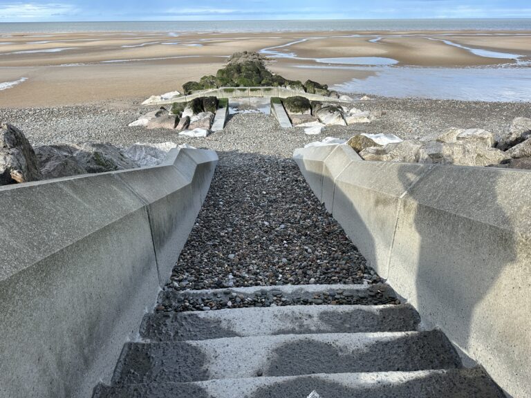
The next element is the rock armour which rises from the beach to absorb the worst of the abrasive waves. The unevenness of the rocks helps to absorb the energy of the waves. The voids between them are just as important as the actual rocks themselves.


Levels of Protection: Concrete
Then the upper part of the seawall, outside of the damage zone, is concrete. A ‘berm’ or spacing footpath separates the rock from the next section which is the precast concrete steps. See the wave wall at the top of the steps, and how it curves to reflect waves back to sea.

The last lines of defence
The whole defence is wide from front to back, with a high wall to the rear. Cleverly, it’s separated into split levels to catch any waves that come over during rough weather, reduce their force then direct them back to the beach. Finally the rear flood wall is the last line of defence for waves.
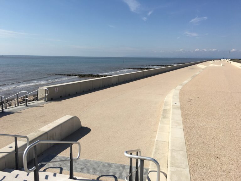
But that’s not the end of this defence! Beyond the hard landscaping of the sea wall with all its man-made concrete lies Larkholme Grasslands. With its soft undulating swathes this natural landscape is an overflow space for any water which does make it over the top. A ‘meandering swale’ and wildlife ponds provide space for seawater and rain while creating an amazing wild habitat.
Read more: about Larkholme Grasslands here
An Amazing Public Space
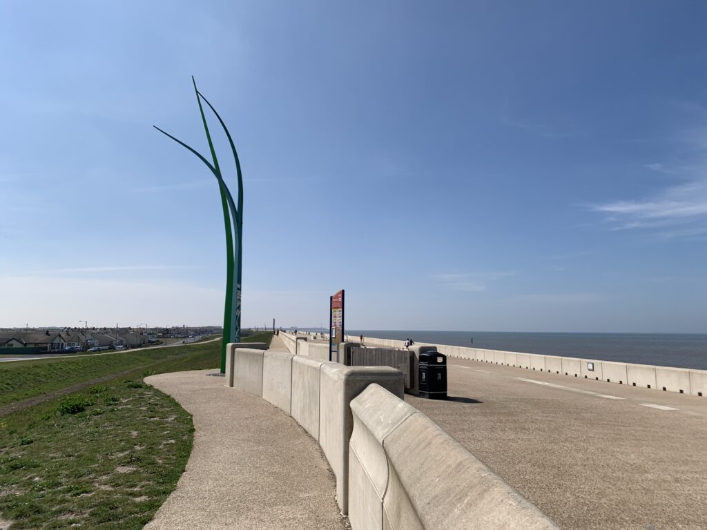
The design disperses the energy of the waves as they crash against the shore, and withstands the constant battering. The wide walkway and split level upper promenade is a pleasant environment linking the coastline between Cleveleys and Fleetwood. It’s an amazing public open space for people to enjoy.
This video is from 7 May 2020. It was part of our ‘Walk on the Beach’ series, and filmed during the first Covid19 lockdown. It ends on Larkholme Grasslands –

Enjoyed this video? Why don’t you subscribe to the Visit Fylde Coast YouTube channel, for loads more great content!



Before and After
The next aerial video clip dates from November 2016 while construction was still underway, starting at the southern end of the scheme at Westway. Contractors worked their way to the northern end of the scheme, adjacent to Fleetwood Golf Course.
You can also see how significantly bigger the new sea defences are. The old sea wall is still visible at the northern end, seen towards the end of the clip.

Enjoyed this video? Why don’t you subscribe to the Visit Fylde Coast YouTube channel, for loads more great content!
Mythic Coast
The Mythic Coast is an artwork trail beginning at Cleveleys, with a memorial to all the ships wrecked off the Fylde coast between 1643 and 2008. Find characters from The Sea Swallow storybook dotted along Cleveleys promenade and beach. Including a giant stainless steel seashell and a sea ogre carved from limestone!
The story of the Sea Swallow appears at both ends of the Rossall seawall, where the new wall meets the existing. The artwork faces the sea and is visible to anyone enjoying the promenade. Have you seen the inscriptions? This one is at the Rossall School/Cleveleys end –

This inscription reads:
Mary held out the shell, though her hands were shaking.
Still the tidal wave rose, higher and higher

Why the Rossall Coastal Defence Scheme is Important
The ingenuity and flair of designers and engineers has given Fleetwood a promenade and public space to be proud of!

The area of Wyre coastline in the Rossall stretch around Fairway was at the end of its useful life. Less than five years of effective life were estimated to be left in the old wall – and the consequences of its failure were unthinkable. Their progressive failure was such that ongoing maintenance wasn’t practical.
The flood defences were old and could fail during a major storm. If they had, the results would have been disastrous. A failure would have meant significant flooding to low lying properties, along with damage to businesses and critical infrastructure.
Past flood events
Flooding has happened before in this area. Floods of 1927 resulted in the deaths of six people and spurred on construction of the front section of 1930’s sea wall.
It happened again in 1977 when over 1,800 properties flooded following a breach of the sea defences. Once again defences were built after the event. This time the rear flood wall, known locally as the ‘Berlin Wall’, was added.
Read more: about flooding in Fleetwood here

Approval of the Scheme
With the sea defences at Rossall nationally recognised as one of the highest risk and most important areas for improvement, funding could be secured. This spot gets some of the highest waves and currents on the Fylde Coast.
In October 2013, Defra and the Environment Agency formally approved £86 million of funding and gave the green light for work to start. The major new coastal defences at Anchorsholme and Rossall are one of the largest flood defence programmes in the UK.
Combined, the works between Rossall Hospital and Rossall Point and from Kingsway to Little Bispham at Anchorsholme, protect 12,000 properties from the risk of coastal flooding.
Designing a new seawall
Hydraulic modelling is used to understand the effect of wave-overtopping and scour, the effects of the waves and the movement of sediment. Experts use this information along with desk studies to design the cross section.
The new scheme covers 1.9km from Westway to the golf course. It follows the line of the existing defences, with no changes to alignment. The width of it ranges from 100 to 130m from the seawall to Fairway. It’s also 0.5m higher than the old sea wall.
The new sea wall is built entirely over the top of the old one – which is the pale grey line on the drawing.

Funding to protect 7500 properties
The new sea defences protect 7,495 properties from flooding. Plus businesses, a number of public buildings and critical infrastructure. These include the NHS Pensions office, Fleetwood High School, Rossall Hospital and more besides. Along with the Blackpool tramway and the mains sewage network.
The approved strategy went to the Environment Agency National Project Board in December 2011. A Business Case followed, put together and submitted in Feb/March 2012.
Public Consultation
This section of coastline is a totally different landscape to the promenade in the centre of Cleveleys. It’s more natural, almost a wild place, ideal for solitude, walking and watching the wildlife. These characteristics are reflected in its design. The results of a full public consultation in early 2010 were also taken into account. That’s why there’s no lighting and commercialisation.
Beach users and residents were consulted about how they would like to see the design of the sea defences take shape. They were asked what pastimes the area and beach was used for. Consultation with the angling community led to the original full rock revetment being changed. The design was adapted to reduce the width of rock and create the lower level berm.
New access points are also incorporated in the new design. There are slades, ramps, an increased number of steps and access from the upper and lower promenades.
Community Backing
Local residents were asked to show their backing for the Shoreline Strategy Plan. Then a formal grant application was made in February 2013. The local community showed tremendous support for the scheme. Over 1500 residents signed pledges of support, plus businesses including Regenda housing association, which manages 900 properties in the area. Fleetwood Town Council increased its annual precept to support the project.
The Fylde Peninsula Coastal Programme secured £86m of funding from the Department for Environment, Food and Rural Affairs (DEFRA). £64m for Rossall and £22m for Anchorsholme. A £17m bid for Fairhaven Lake and Church Scar was also successful.
Working Together
Works also included the promenade on Princes Way at Anchorsholme as one package. Birse Coastal (later to become part of Balfour Beatty) secured the contract against tenders which went out in early 2012.
- Read more about: the Anchorsholme Sea Defence scheme here.
Blackpool and Wyre Councils worked together to draw down the funds and manage the project as one team. That way they could deliver better value for money by combining expertise and resources.
The Anchorsholme scheme includes the reconstruction of 1km of concrete sea wall defences with promenade and landscaping details.
Building the Rossall Coastal Defence Scheme
Here at Visit Fleetwood we were fortunate to be involved in the Rossall Coastal Defence Scheme throughout construction. So we got to see the complete transformation from the old, failing wall to the amazing public space it is today. You’ll see some of the building process below. Take a look through these updates to see the transformation into an amazing piece of public realm from an old seawall at the end of its useful life.
Site Compounds
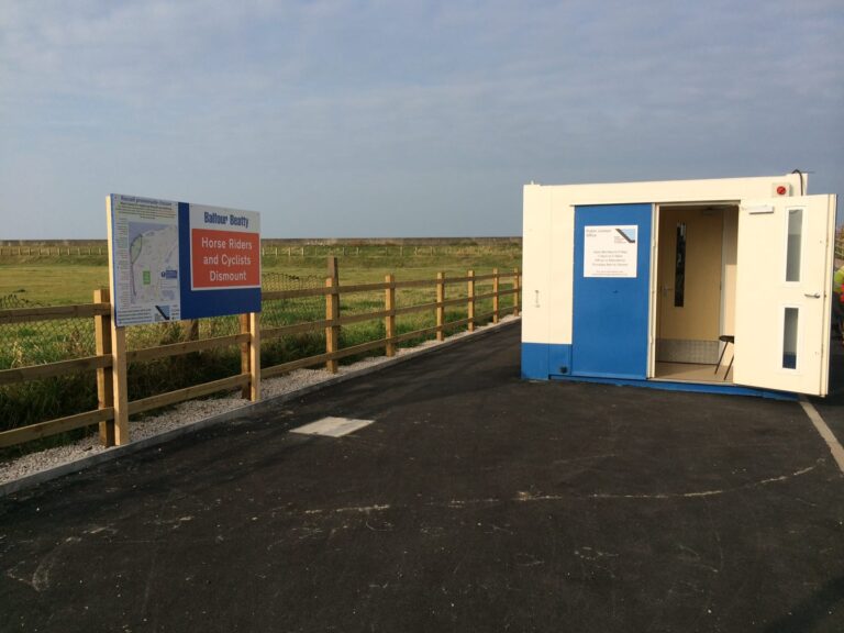
You might remember the site offices, they were based on the car park at the end of Westway.

This little public information cabin was open for the duration of the works. Inside were plans, posters and photos of the works underway.
In February 2015 an additional storage area was built as construction activities increased. It was within the lagoon, seaward of the concrete drainage channel, between the Larkholme Parade access path and the site compound. The topsoil was stripped off and stored, the land covered in recycled material then used as a haul road and storage area. Two piped bridges were built across the concrete channel to allow vehicles to turn around.
As work reached the northern end of the site, another compound was later built at the Chatsworth end of the job.
Rock Delivery and Stock Piling
Work began building the new defences back in April 2014. The first phase centred predominantly on importing rock armour and constructing the lower revetment. This work was largely out of view.
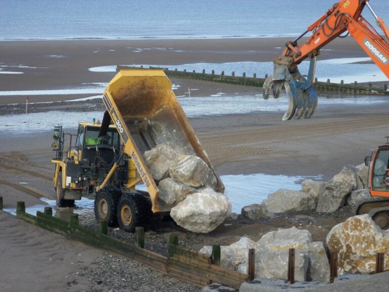
Delivery and stockpiling of rocks was a major undertaking in itself! The rocks, each weighing between 2.5t and 10.5t, are used to construct the rock groynes and the lower half of the sea defence revetment. Approximately 50,000 rocks were brought to site, from a dozen quarries within a 100 mile radius of site.
Each rock was weighed and sorted into stockpiles on the beach, ready to be picked and placed.

In the early days of the project, the team also had to make repairs to the existing defences. As it’s such a big job, the rest of the sea wall couldn’t be left to wash away.
Rock Armour Revetment
The rocks remove a significant amount of energy from the incoming tide and also deal with the abrasive nature of the sea below high water. They will weather the harsh conditions on this exposed part of the coastline and allow the beach to build up.
270,000 tonnes of rock armour were used to create the base of the defences.
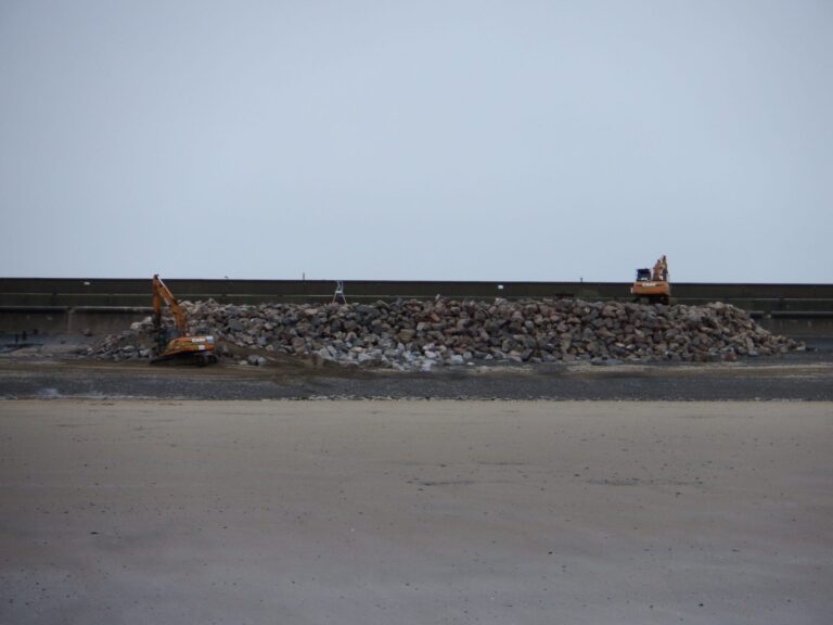
The rock revetment has to be constructed first, before the sea defence structures can be built above them. Only a 5 metre strip can be completed on a suitable tidal shift – so it’s a slow process.
Assembling the rock revetment
During each tidal shift the beach is excavated to the required profile. A 5 metre wide geotextile mat is laid in the bottom of the excavation. The geotextile is a structural fabric and acts as a separation layer between the beach and rock.
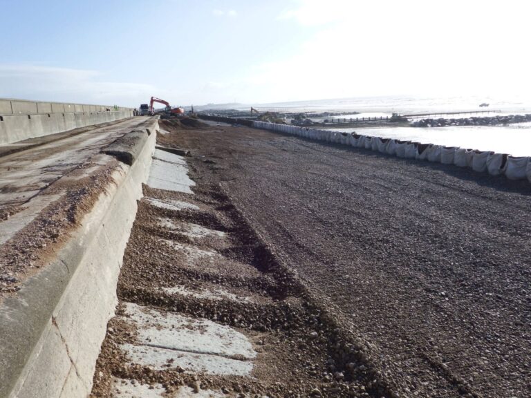
A 1.8 metre thick layer of underlayer rock is placed on the geotextile, with a 2.4 metre thick layer of larger rocks placed on top.
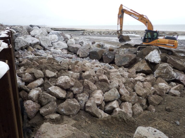
Each rock is carefully and accurately placed. They have three contact points to ensure they are stable and don’t move. The voids between the rocks are just as important as the rocks are themselves.
From the face of the sheet piles the rock revetment is 25 metres wide towards the sea. Every 1 metre length of revetment uses 64 tonnes of underlayer rock and 100 tonnes of the larger rock!
Rock Groynes
The rock groynes help to retain beach material along the foreshore and encourage the beach to build up in height. High beach levels help to reduce the height of waves which can be generated during storm conditions. It’s the first line of defence in the new works.

Just like most of a floating iceberg is underwater, most of a rock groyne is under the sand. In reducing the turbulence of the sea they allow the finer sand to settle out of suspension and build up the beach.
Beach Access Steps
Beach access steps are built-in and cross the rock revetment. They are also concrete, cast in-situ.
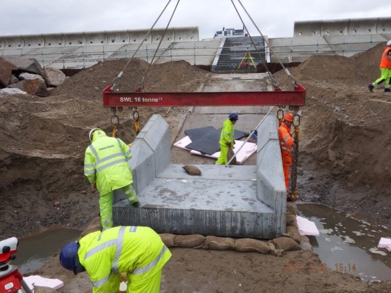
Groyne Crossover Ramps
Each set of access steps ends in a groyne crossover ramp, also cast on site. There’s a pre-cast wall between the steps and the rocks.
The purpose of the groyne crossover ramps is to allow free access across the beach. It also means you’ve always got access to a stairway when the tide is coming in.

Sheet Piling
Steel sheet piles stabilise the sea wall. They’re installed along the full length, between the rocks and the upper concrete levels.
The piles are long lengths of shaped metal, designed to interlock when they’re in place. Individually, they’re driven vertically into the ground with a piling rig – with most of them vibrated into place. It’s amazing to watch – they go in like a knife into butter. Watch this clip, filmed during a public site visit.

Enjoyed this video? Why don’t you subscribe to the Visit Fylde Coast YouTube channel, for loads more great content!
In places there is rock and hard clay underground. Some piles needed ‘persuading’ into the correct position with a drop hammer, after being vibrated in as far as they’d go.
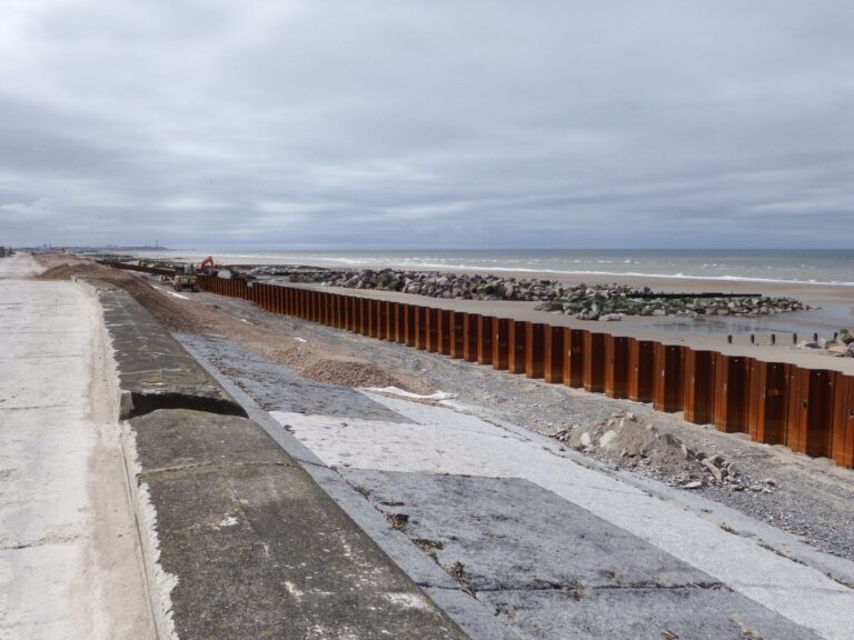
Graded stone is added on the landward side of the piles and compacted to fill the voids between the sheet-piles and old sea wall. It forms part of the foundation for the precast concrete blocks which come later.

Step Units
Between the rock revetment and the promenade, specially manufactured precast concrete sections form a stepped revetment to break the waves. There are more than 1000 units in total, and each one is the weight of around two double decker buses.
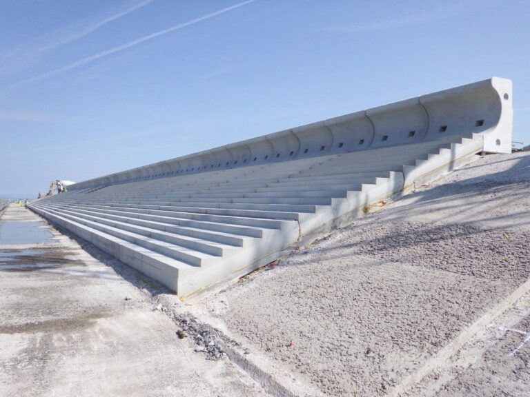
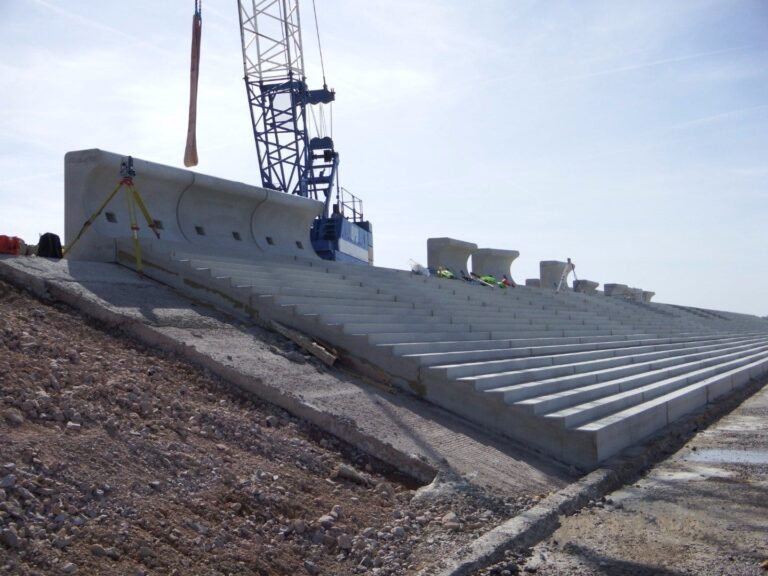
A team of workers first prepare the revetment blinding, working about 120 metres ahead of the crane and team installing the pre-cast units. Placement of the step units began on Thursday 3 March 2016. On average, the team could install seven/eight of them during each working day.
A crane with a vacuum lifting unit picks up and and positions the pre-cast steps. This does away with the need for lifting eyes and nasty holes in the finished surface.


Construction of the upper precast concrete revetment was significantly quicker than the lower level rock. Once the team were out of the tidal area they could continue normal working hours each day.
The Top Level Promenade
The new promenade is significantly wider than the old one. Precast concrete wave wall units sit at the top of the stepped revetment. Their job is to reflect waves back to sea. The top of them is over 2m higher than the walls which they replaced.
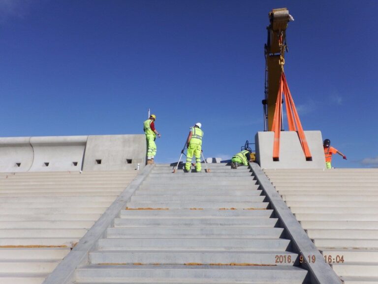
However the rear flood wall against the grasslands is only approx 30cm (one foot) higher than it was. The efficiency of the new design means that the rear wall doesn’t need to be any higher.
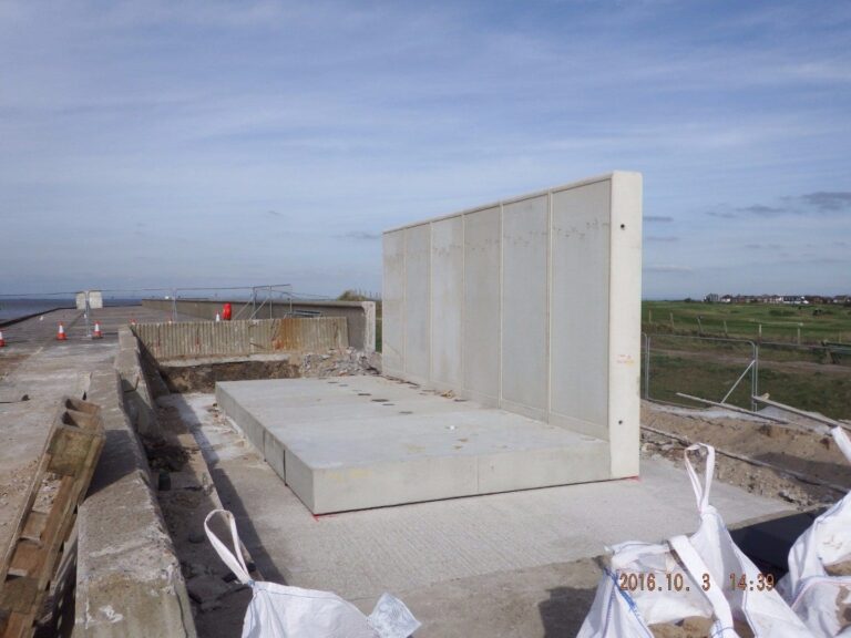
The northern tie-in walls (below) are different to the standard rear walls as they have to allow for the new higher promenades to ramp down to meet the existing promenade.
Split level pathway
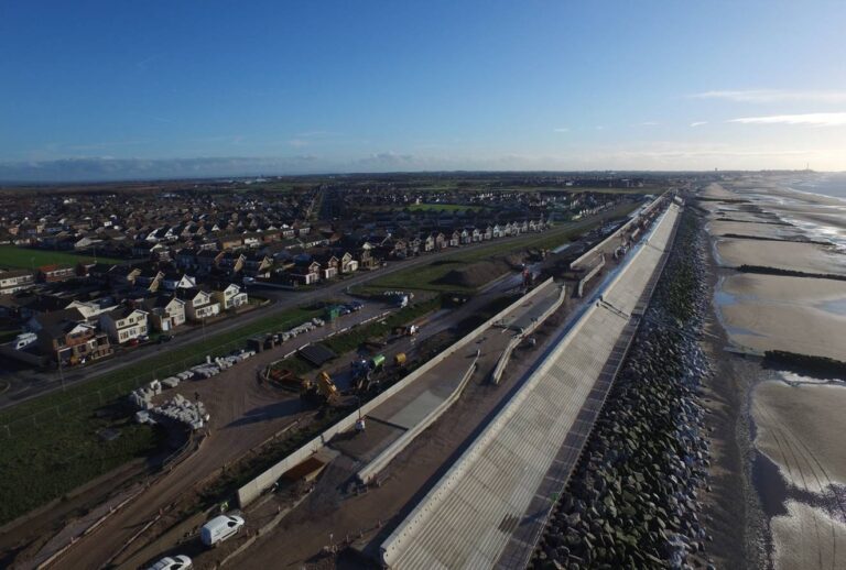
There’s an intermediate wall along the full length of the promenade. It’s not just an attractive feature and a huge seat. It has an important function in trapping sea water.

You can see the arrangement of these two split levels, and the access ramps/steps between them, in this aerial photo from January 2017.
A Test from Storm Eleanor
On 3 January 2018, Storm Eleanor blew into town, to test out the almost complete sea wall.
The site offices were at the southern end of the scheme, where the new wall joins the old at Rossall School. It was possible to safely take photos from there, showing how the new wall deals with the storm conditions, compared to the old.
This photo is looking along the top of the intermediate recurve wall, between the steps and wide promenade. The recurve wall is about 4′ high.

Standing on the promenade you can see how little sea and debris is washing over the recurve wall.

By comparison…
In contrast, at the southern end of the scheme where the new wall meets the old wall, it was business as usual!
This photo is looking from the new sea wall at Westway, south towards Cleveleys. The big wave is in front of Rossall School field. You can see the school buildings at the left.

Where the new wall ends in the the centre of the photo you can see enormous waves are forming. They’re battering the old wall and going over the top. This one photo shows just how effective the new wall is.
Opening the Rossall Coastal Defence Scheme
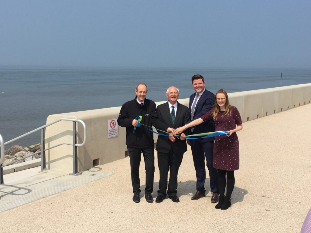
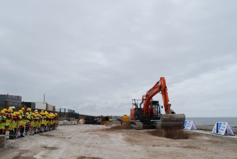
Sir James Bevan, Chief Executive of the Environment Agency and Dean Banks, Balfour Beatty Chief Executive Officer for UK Construction Services were at the opening. Along with Councillor Roger Berry, Neighbourhood Services and Community Safety Portfolio Holder at Wyre Council and Fleetwood MP Cat Smith.
The new Rossall Coastal Defence Scheme officially opened on 1 June 2018.
A symbolic ribbon cutting ceremony marked the event.

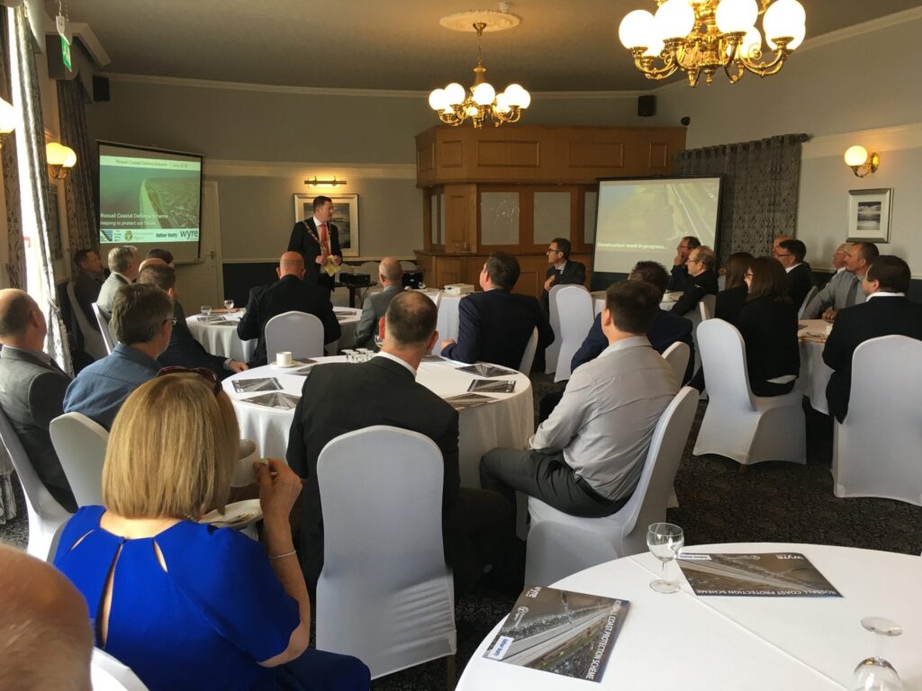
Take a look at the photos from the opening day –



Other related pages –
- Tank Traps at Rossall School
- The Rossall Hoard of Roman Coins
- Rossall Point Seafront
- Have you seen Rossall Tower?
- Fleetwood Beach Landmarks
Time capsule buried underneath Rossall Coastal Defence Scheme
Published July 2016
Pupils from Northfold Primary School in Thornton Cleveleys were inspired to fill a capsule following a trip to see the defences being built. They’ve left a lasting legacy for a future generation to discover, buried below the new promenade.

Items inside the time capsule include photos and mementos of everyday life. Newspapers and currency to illustrate daily life now, along with facts about the children and messages to the future.
The children wrote about current hot topics such as the EU referendum and climate change. They’ve also asked questions of would-be future readers.

A Legacy for the Future
Air and water-tight, the time capsule is expected to survive in its hiding place for at least a hundred years. That’s the lifespan of the new sea defences.
James Rochester, Class 6 teacher at Northfold Primary School, said: “Class 6 have been learning about how coastlines change over time. So visiting the Rossall Coastal Defence Scheme provided amazing first hand insight. The chance to observe the defences gradually taking shape was fascinating.
“The children benefited from consolidating their class based learning with a real life experience. They’ve also had an opportunity to leave a lasting legacy and footprint about their own lives, as well as Northfold C.P. School and the surrounding area as it is in 2016.”
An Earlier Time Capsule
A time capsule was also found at Cleveleys in 2005 at the start of the third phase of sea wall works. It’s believed that it was buried in 1929 when the previous sea defence work was completed. Work on the previous Cleveleys sea wall began in September 1927. North Promenade opposite Jubilee Gardens opened in May 1937. The ‘missing link’ joining Cleveleys with Fleetwood opposite Rossall School opened in May 1939.
Nick Watts, a local author, has produced a very interesting book about building the Rossall sea wall, which is available to buy from Amazon.
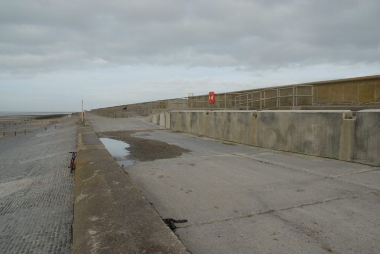
What Rossall Sea Looked Like Before Construction Works
How quickly you forget! Take a look at Visit Fleetwood’s own collection of photos dating back before these works. These were all taken in 2009.


While you’re here…
Go to the homepage of the Visit Fleetwood website for the latest updates.
Love the Fylde Coast? Sign up for your email newsletter. Packed full of interesting things it arrives in your inbox all 52 weeks of the year.
Join us on Facebook at our Visit Fylde Coast Facebook Group and follow us on Twitter @visitFyldeCoast
Plus hundreds of videos to watch on our YouTube channel – from all over the Fylde Coast!
Booking a stay? Pick a safe, clean and legal place to stay, at the very best price. Book with the Visit Fylde Coast and StayBlackpool guide.

We Need Your Help
We Need Your Help



I’m a relative newcomer to the area and gradually finding my way. Thank you for your time and effort and obvious interest in compiling this information together.
Thanks for saying so Alan!
Walked along the new coastal defence scheme yesterday 30/8/2020 with my Mum in her wheelchair. It was a clear day with lovely views in all directions. First trip out for Mum in months as she’s been shielding. We were all so impressed with what’s been done; this is a really lovely public space, accessible for all, clean and well used. I had no idea it was there – what a great surprise. Excellent job. Well done all involved.
Why was this event not made public
We when down to watch as a family and we saw nothing told 2 o’clock by
Officials and it was all over when we got there at 1.30 we was very disappointed
Also how many of the four people who cut the ribbon live in Fleetwood
It should of been made by Fleetwood children the future of Fleetwood
And it all looks very beautiful it really surprised me how good it looks
The only bad thing I could see wrong was the rocks they are accident waiting to happen they very are dangerous for kids and dogs